The Peak District is a hiker’s paradise, offering stunning landscapes and challenging terrain. But navigating these wild spaces requires a certain set of skills. That’s where the Map Reading and Navigation Course comes in. Designed for both novice and experienced trekkers, this comprehensive program equips participants with the essential tools to confidently explore the region. Led by an expert guide, the course covers everything from map reading to terrain analysis, providing hands-on activities and insightful commentary. Whether you’re looking to enhance your navigation abilities or simply want to make the most of your time in the great outdoors, this course is not to be missed.
Key Points
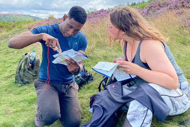
- A full-day map reading and navigation course is offered in the Peak District, UK, suitable for both novice and experienced hikers.
- The course covers essential skills like measuring distances, taking bearings, interpreting terrain, pacing, and understanding map scales and grid systems.
- The course is taught by an experienced guide and includes hands-on activities to practice navigation techniques like using a compass and planning efficient routes.
- The course is held on Tuesdays and Saturdays, with the meeting point at Bamford in Hope Valley, S33, UK, near public transportation.
- Participants must book the course in advance, and confirmation is usually provided within 48 hours, with a maximum group size of 8 travelers.
Course Overview
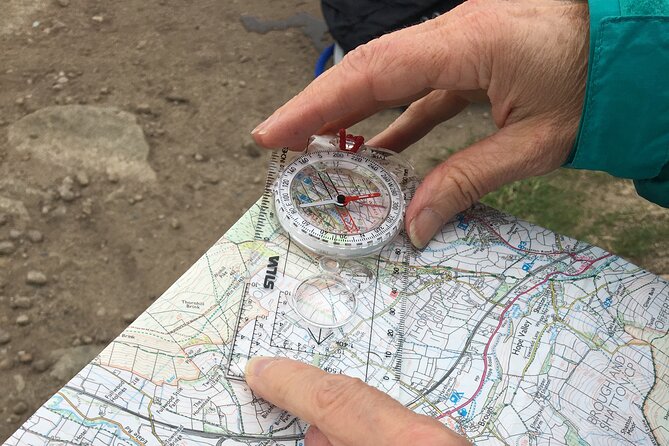
The Peak District’s Map Reading and Navigation Course, which boasts 47 reviews, offers a full-day program designed to hone participants’ navigation and map-reading abilities in Sheffield, England.
This comprehensive course covers essential skills, from taking bearings and pacing to understanding terrain and planning routes using maps, scales, and compasses.
With insightful commentary from the guide, learners will gain confidence in using different types of compasses and mastering the art of map reading.
Whether you’re a novice or an experienced hiker, this course promises to sharpen your navigation skills and equip you with the knowledge to navigate the great outdoors with ease.
You can also read our reviews of more tours and experiences in Sheffield.
Course Curriculum
This course covers a range of essential map reading and navigation skills, teaching participants how to take accurate measurements and bearings, pace themselves, and understand different types of terrain.
Attendees will learn how to plan routes using maps, scales, and the grid system, as well as how to effectively use a compass.
The curriculum is designed to build confidence in practical map reading and navigation techniques, equipping participants with the knowledge and tools to navigate confidently in the outdoors.
Throughout the day, the experienced instructor will provide insightful commentary, ensuring learners leave the course feeling empowered and ready to apply their newfound skills in the Peak District’s stunning landscapes.
Instructor and Activities
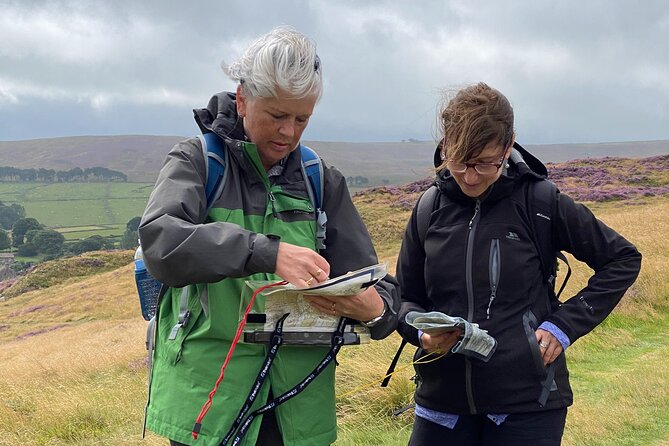
During the course, you will hear insightful commentary from the experienced guide, who’ll share their deep knowledge of the area.
They’ll also learn about different types of compasses and how to properly use them, gaining confidence in both map reading and navigation techniques.
The guide will lead hands-on activities that allow students to practice essential skills like taking bearings, pacing, and understanding terrain features.
Logistics
The course meets at Bamford in the Hope Valley region of S33, UK, with the departure point being The Adventure Hub operated by Pure Outdoor Ltd. Participants can choose to attend on either a Tuesday or Saturday, with the daily start time set for 9:30 am.
Participants will receive confirmation within 48 hours of their booking.
It’s essential to dress appropriately for the outdoor adventure.
The course isn’t wheelchair accessible, but service animals are welcome.
The location is conveniently near public transportation options.
Most travelers can participate, with a maximum group size of 8 individuals.
Participant Information
Participants can expect a full-day of engaging activities and instruction to sharpen their map reading and navigation skills in the beautiful Peak District.
The course is suitable for most travelers, and the group size is limited to 8 people to ensure personalized attention from the expert guide. Participants should dress appropriately for the weather and outdoor activities.
While the course isn’t wheelchair accessible, service animals are welcome. The meeting point is conveniently located near public transportation in Bamford, Hope Valley.
Participants will receive confirmation within 48 hours and are advised to arrive at the starting time of 9:30 am at the Adventure Hub, operated by Pure Outdoor Ltd.
- Sheffield to Manchester Airport
- Sheffield: Gin Experience – Make Your Own Gin
- Fun, Flexible Treasure Hunt Around Sheffield With Cryptic Clues & Hidden Gems
- Sheffield: Family Bike Rental, Peak District, Trails & More
- Sheffield: Murder Mystery City Exploration Self-Guided Game
- 7 Hours Pub Tours in Peak District
Map Reading Skills
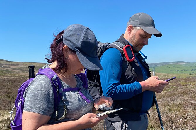
One learns a range of fundamental map reading skills throughout the course, including measuring distances, taking accurate bearings, and interpreting terrain features depicted on the map.
The curriculum covers essential techniques such as:
- Pacing to estimate distance traveled
- Understanding the grid system and map scales
- Using a compass to determine direction
- Identifying contour lines and elevation changes
- Planning efficient routes by analyzing the map
Gaining proficiency in these skills empowers participants to navigate the Peak District’s diverse landscapes with confidence, whether trekking through valleys, scaling hills, or exploring hidden trails. The hands-on approach and expert guidance ensure that each student walks away with practical map reading abilities they can apply on future adventures.
Navigation Techniques
Along With map reading skills, the course equips participants with a range of practical navigation techniques they can employ to traverse the Peak District’s rugged terrain. Attendees learn how to use a compass effectively, taking accurate bearings to guide their route. They also practice pacing – counting steps to measure distance covered – an essential skill when visibility is poor. Understanding terrain features like contour lines and elevations helps hikers anticipate challenging sections ahead. By the end, participants feel confident planning efficient routes and navigating safely, even in unfamiliar environments.
| Navigation Technique | Description | Application |
|---|---|---|
| Compass Use | Taking accurate bearings | Determining direction |
| Pacing | Counting steps to measure distance | Estimating travel time |
| Terrain Analysis | Interpreting contour lines and elevations | Route planning |
Booking and Confirmation
To book the Map Reading and Navigation Course in the Peak District, interested parties can check the available dates and submit their reservation through the Adventure Hub website or by contacting Pure Outdoor Ltd. directly. Booking confirmation is usually provided within 48 hours, so you’ll know quickly if your spot is secured.
Dates are offered on Tuesdays and Saturdays.
The course starts promptly at 9:30 AM.
Maximum group size is 8 travelers.
Participants should dress appropriately for the outdoors.
The location is accessible via public transportation.
With quick confirmation and flexibility in scheduling, it’s easy to plan your navigation skills adventure in the beautiful Peak District.
Frequently Asked Questions
What Is the Typical Group Size for This Course?
The typical group size for this course is a maximum of 8 travelers. The course provides a small, intimate setting where participants can learn and gain confidence in their map reading and navigation skills.
Are There Any Prerequisites or Prior Experience Required?
There are no prerequisites or prior experience required for this course. It’s designed for beginners and those looking to develop their navigation skills. All levels are welcome to join and learn the essentials of map reading and using a compass.
Is There Any Gear or Equipment Provided by the Organizers?
The organizers provide the necessary equipment for the course, including compasses and maps. Participants don’t need to bring their own gear, though they should dress appropriately for the outdoor activities.
Can Participants Bring Their Own Food and Drinks?
Participants are welcome to bring their own food and drinks. The course organizers don’t provide meals, but there may be opportunities to purchase snacks or beverages locally during breaks in the program.
What Is the Cancellation and Refund Policy for the Course?
The cancellation and refund policy allows full refunds for cancellations made at least 7 days before the course date. Cancellations within 7 days are subject to a 50% refund. No refunds for no-shows.
Recap
The Map Reading and Navigation Course in the Peak District is an invaluable opportunity for both novice and experienced hikers.
Taught by an expert guide, the course equips participants with essential skills to confidently navigate diverse landscapes.
With hands-on activities and insightful commentary, the program is a must-attend for anyone seeking to enhance their map reading and navigation abilities in the scenic Hope Valley.
More Tour Reviews in Sheffield
- Sheffield: Gin Distillery Tasting Visit with Guided Tour
- Sheffield: National Emergency Services Museum Entry Ticket
- Sheffield: Electric Bike Rental Explore the Peaks & Beyond
- Sheffield: City Walking Tour and Exploration Game
- Immersive Murder Mystery in Sheffield – Outdoor Escape Experience
- Sheffield: Uk/ Europe Esim Roaming Mobile Data Plan
