
Exploring Iceland’s stunning landscapes often means hiking past glaciers or marveling at their icy majesty from a distance. But this tour offers something quite different: a chance to become a Katla Geopark Civilian Scientist and actively participate in mapping Sandfellsjökull Glacier. It’s a full-day adventure that mixes science, spectacular views, and a meaningful sense of contribution. While it’s not your typical sightseeing trip, it’s perfect for those craving an experience that’s both educational and memorable.
Two things really stand out about this experience. First, I love the opportunity to contribute directly to climate research — it’s rare to get a hands-on role in scientific work during a vacation. Second, the spectacular scenery surrounding Sandfellsjökull is genuinely breathtaking, with views that are sure to leave a lasting impression. That said, this is a moderate physical activity requiring some stamina and good weather, so it’s not suited for everyone, especially those with mobility issues or expecting a relaxing cruise.
One possible consideration is the limited group size and the need to adapt plans based on weather or safety concerns. If that’s a dealbreaker, it’s worth knowing that plans can shift, but that’s also what makes the experience authentic and safe.
Key points / Takeaways

- Unique scientific involvement: You get to actively contribute to climate change data by mapping a glacier.
- Expert guidance: The tour offers training from local scientists, giving you a behind-the-scenes look at glacier science.
- Spectacular scenery: Expect jaw-dropping views of Iceland’s icy landscapes, often with changing weather adding drama.
- Inclusive experience: Suitable for active travelers in good physical condition who love the outdoors.
- All-in-one package: Transport, equipment, training, and a certificate are included, providing great value.
- Weather-dependent: Be prepared for possible itinerary changes due to weather conditions, which are common in Iceland.
Exploring Iceland’s Glaciers from a Different Perspective

Many travelers see glaciers from afar — through photos, scenic drives, or distant hikes. This tour offers a rare chance to go beyond passive sightseeing and actually work with glacier mapping tools, helping scientists gather crucial data on Sandfellsjökull. Led by knowledgeable locals, the experience is designed to be both educational and engaging, making you feel like a real scientist for a day.
The tour departs from Hvolsvöllur, a small town in South Iceland, and involves a full day of approximately 8-10 hours. The highlight is the round-trip in a sturdy 4×4 vehicle, which takes you to the glacier’s edge, where the real adventure begins. The guides, often referred to as experts or citizen scientists, are enthusiastic and committed to sharing their knowledge, which makes the experience all the more enriching.
What truly sets this apart is the blend of learning and doing. You’re trained to use glacier and mapping equipment, then given the task of creating detailed maps of the glacier’s surface. This isn’t just a tourist activity — your efforts contribute to ongoing climate research, and you even receive a Citizen Scientist Certificate. Afterwards, you’ll get updates on how your data is used, offering a real sense of purpose.
You can also read our reviews of more tours and experiences in Vik.
What to Expect on the Day
The day begins with a training session where guides explain the science behind glacier formation, the importance of monitoring glaciers in relation to climate change, and how to operate the mapping equipment. Expect to learn about Sandfellsjökull’s formation, its history, and its dynamic nature — which is fascinating, especially if you’re interested in environmental issues.
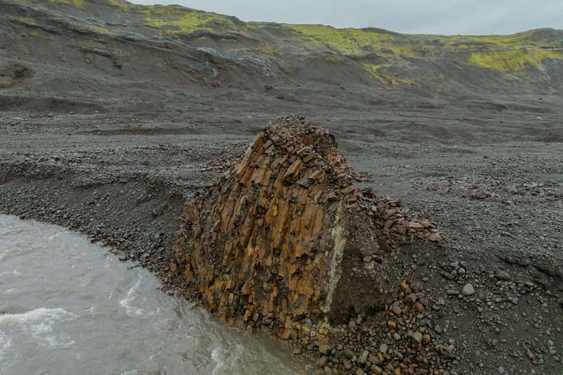
After training, you’ll hop into the 4×4 for a scenic drive across the Icelandic landscape, with the glaciers looming in the distance. The drive itself offers photo-worthy vistas — think rugged volcanic terrain, mossy lava fields, and icy peaks. Once at the glacier, you’ll don your hiking shoes, waterproof clothing, and other gear, preparing for a trek onto the ice.
The actual mapping involves walking across the glacier surface, using special equipment (which your guides will instruct you on). You’ll mark features, note crevasses, and gather data that helps scientists understand how the glacier is changing over time. This is physical work, so good physical condition is recommended. The terrain can be uneven and sometimes challenging, but guides are attentive to safety, and the moderate difficulty level makes it accessible for most active travelers.
Throughout the day, expect spectacular views of the icy expanse, often contrasted against the deep blue sky or overcast clouds, depending on the weather. Guides often share insights about the glacier’s past, how it’s been impacted by climate change, and what future changes might look like.
By late afternoon, you’ll return with your data, a sense of accomplishment, and a certificate recognizing your role as a Citizen Scientist. The experience concludes with a debrief and a chance to ask questions about what you’ve learned.
Transportation, Duration, and Group Size

Transport is included in the form of a round-trip in a 4×4 vehicle from Hvolsvöllur, making logistics smooth and comfortable. The tour lasts about 10 hours, including travel and time on the glacier, which means you’ll want to set aside a full day. The group is private, enhancing the personalized feel, with guides ensuring you get plenty of individual attention and training.
Group sizes are limited — this isn’t a large bus tour but a more intimate experience that allows for safety and tailored instruction. The modest size also means you’ll get to ask plenty of questions and partake actively in the mapping process.
Who Will Love This Tour?

This experience is ideal for adventurous, active travelers who enjoy outdoor challenges and want a deeper understanding of climate issues. It suits those comfortable with moderate physical activity and who are curious about science but prefer their adventures hands-on rather than passive. If you’re traveling with older children (over age 10) or adults who love nature and learning, this could be a perfect fit.
However, it’s not suitable for pregnant women, people with mobility impairments, or those with heart problems due to the physical demands and terrain. Expect weather variability; packing layers, rain gear, and waterproof clothing is essential.
More Great Tours NearbyPrice and Value Analysis
The cost includes training, transportation, equipment, and a certificate, which adds up to significant value, especially considering the unique scientific contribution you make. Compared to standard glacier tours that might only offer photographs and short walks, this one offers an educational component and ongoing research updates — a rare combination.
While it’s more expensive than a typical day tour, the price reflects the personalized training, scientific involvement, and the chance to leave a tangible mark on climate data collection. For travelers eager to combine adventure with purpose, the experience is well worth it.
Practical Tips for Booking and Preparing
- Book early since group sizes are limited.
- Wear warm, waterproof clothing and sturdy hiking shoes.
- Bring snacks, water, and a rainproof camera.
- Be prepared for changeable weather — Iceland’s weather can shift quickly.
- Since the tour involves physical activity, ensure you’re in good physical condition.
- Remember, the tour is not suitable for children under 10, pregnant women, or those with mobility issues.
The Sum Up
If you’re looking for more than just sightseeing—if you want to contribute to climate science while surrounded by stunning Icelandic scenery—this glacier mapping expedition offers a rare and meaningful experience. The combination of expert guidance, breathtaking vistas, and active participation makes it stand out among Iceland’s many glacier tours.
Ideal for curious, active travelers who want an authentic, hands-on adventure, this tour lets you see Iceland’s glaciers in a completely different light. You’ll leave not just with photos, but with a tangible sense of having helped advance important environmental research.
For anyone eager to combine adventure, learning, and purpose, this experience is a memorable way to spend a day in Iceland’s wild landscapes.
FAQ

What is included in the tour?
The tour includes full-day guided experience, expert local guides, citizen scientist training, round-trip 4×4 transportation, glacier and mapping equipment, and a Citizen Scientist Certificate. Afterward, you’ll receive updates on your contributions.
How long does the tour last?
It lasts approximately 10 hours, including travel time and glacier mapping activities. Exact start times vary, so check availability when booking.
What should I bring?
Bring warm clothing, snacks, water, waterproof shoes, and a rainproof camera. Weather can be unpredictable, so dressing in layers and rain gear is smart.
Is this suitable for children?
No, this experience is not suitable for children under 10 due to physical activity and terrain. It’s best for active, physically fit travelers.
What’s the difficulty level?
It’s considered moderate, requiring good physical condition because of walking on uneven terrain and cold weather conditions.
Can the itinerary change?
Yes, plans may shift based on weather or safety considerations. Guides will keep safety as the priority and inform you of any adjustments.
This glacier mapping tour offers a rare chance to see Iceland’s icy giants through the lens of science, making it perfect for those who crave authentic experiences that leave a positive impact.
You can check availability for your dates here:More Tour Reviews in Vik
Not for you? Here's more things to do in Vik we have recnetly reviewed
- Reykjavík: Southern Iceland 6-Day Self-Drive Tour
- Skaftafell National Park: Falljokull Ice Climb and Hike
- Skaftafell: Ice Cave Tour and Glacier Hike
- From Vik: Katla Ice Cave and Super Jeep Tour
- Reykjavik: Jokulsarlon Glacier Lagoon Full-Day Guided Trip
- Sólheimajökull: Glacier Hike Adventure
- From Reykjavík: Best of Iceland 6-Day Stopover Tour
- Sandfellsjökull: Glacier Mapping Expedition
- Vik: Guided Sólheimajökull Glacier Hike
- Snowmobiling on Eyjafjallajökull
- Iceland Express Circle – 6-Day Self-Drive
- West and South Iceland – 7-Day Self-Drive